Let's process this file by PENTAP. Un-gzip
downloaded measurements from KOS1 station.
There should be available KOS100NLD_R_20241300000_01D_30S_MO.crx file in Compact RINEX format.
Then open PENTAP PPP online processing.
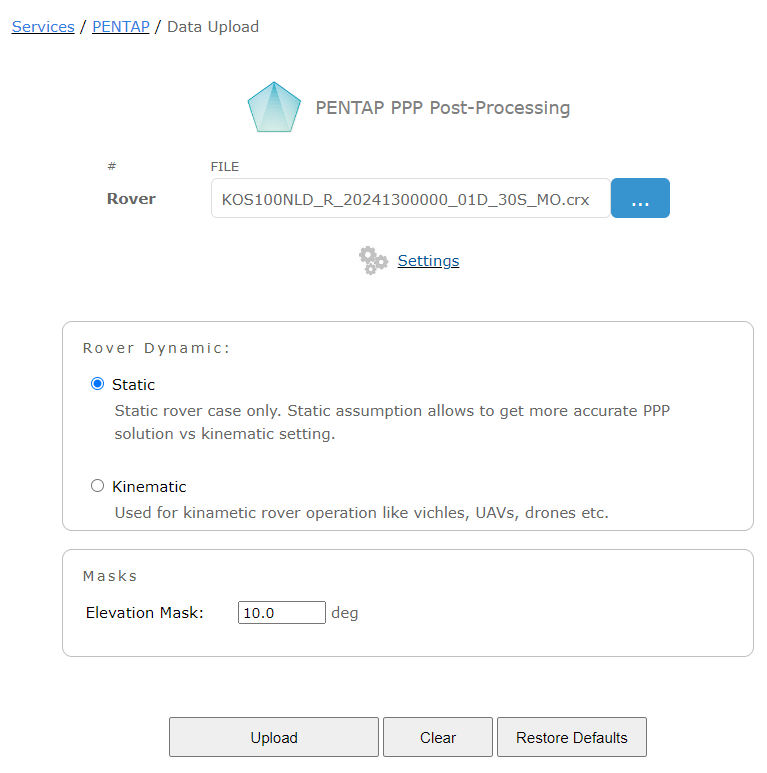
Select CRX file w/ measurements. PENTAP settings may be kept as it. Finally, press UPLOAD button.
Once processing is completed, one may check the results, input settings.
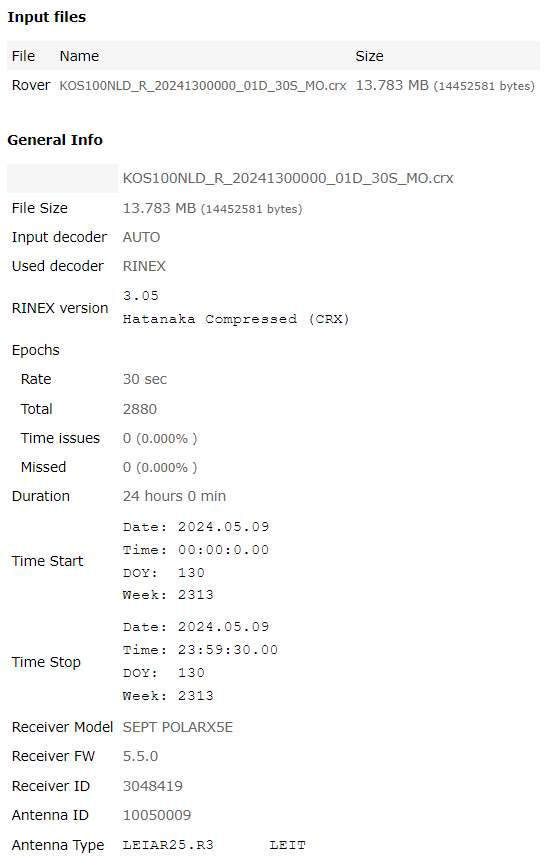
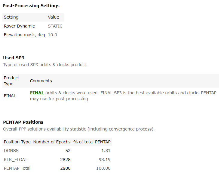
It is important to ensure FINAL precise orbits and clocks (SP3) are used in PPP processing.
Accuracy of SP3 (receiver positions accuracy in turn) strongly depends on product type (FINAL, RAPID or ULTRA-RAPID).
The best accuracy is achieved if FINAL SP3 product is used. It is available w/ delay about 1 week.
Since, we're processing raw data collected long time ago (09-May-2024) in this article - no need to worry about type of SP3 product. FINAL should be available.
However, if one would like to process any arbitrary file it is very important to keep in mind type of SP3 products used.
As mentioned above, the best accuracy is - FINAL SP3 available w/ delay about 1 week.
Somehow fine accuracy may be get w/ RAPID orbits & clocks product (delay about 1 day).
The worst case is ULTRA-RAPID product available w/ delay of few hours (worst accuracy). Running PENTAP on data collected 'now' may lead to accuracy
degradation or even inability to compute positions if even ULTRA-RAPID product is not yet available.
Data collected 'today' better to be processed 'tomorrow' when at least RAPID orbits & clocks are available
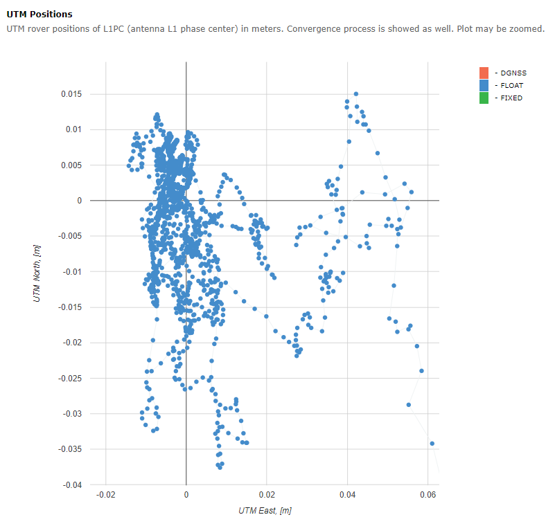
If raw file was not too huge, PENTAP results also include interactive UTM view w/ every epoch processed.
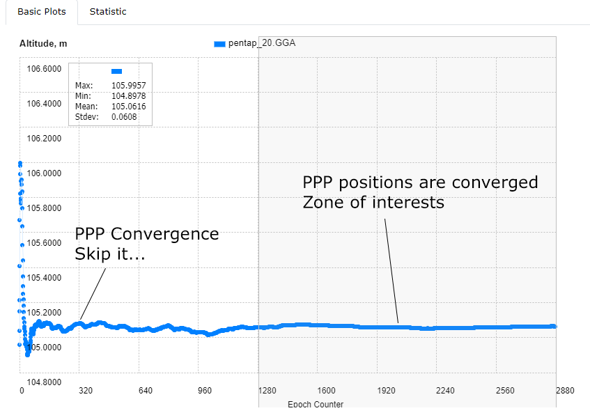
Convergence process is removed by zooming at the figure below.
At the bottom of results page, one may download NMEA,GGA file w/ all the positions computed by PENTAP (there is detailed text CSV file as well for detailed analysis).
Please be informed, positions are tagged to antenna L1 Phase Center (L1_PC) by default, not ARP.

Let's remove convergence process and keep only converged positions. Plot NMEA,GGA file downloaded above and zoom an area of interests (convergence process completed, position is stabilized):
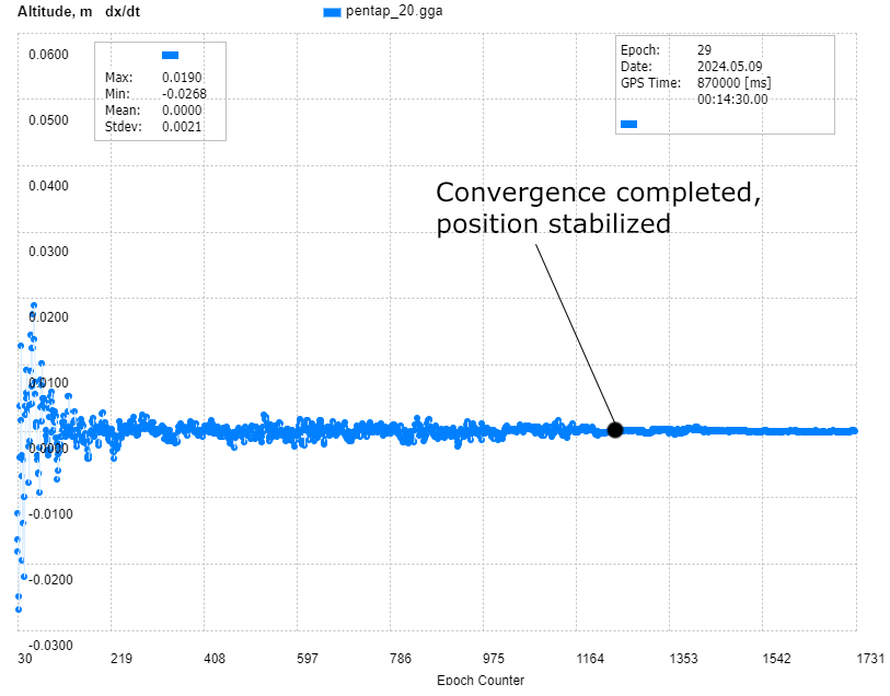
How to determine where PPP convergence is completed? One of the simples ways - is to plot first derivative of altitude or horizontal position components.
Once derivative fluctuations become minimal - that is that very place where we may assume PPP convergence is finished.
Average coordinates (LLA or BLH and XYZ) of PENTAP positions over zone of interests are:
Lat, deg  52.17336096513
Lon, deg  5.8182342110502
Alt, m    105.0610
X, m      3899613.5700
Y, m      397362.1873
Z, m      5014739.2415
By default, PENTAP provides positions tagged to L1_PC. Let's convert L1 Phase center position to ARP (Antenna Reference Point).
PCO (Phase Center Offsets) for LEIAR25.R3 LEIT antenna are the following:
PCO LEIAR25.R3 LEIT
GPS L1:
North:   0.17 mm
East:    0.1  mm
Up:    161.73 mm
North and East components may be neglected (sub-millimeter). Up component is to be subtracted from L1_PC altitude being converted to meters (LLA format).
Lat, deg  52.17336096513
Lon, deg  5.8182342110502
Alt, m    105.0610 - 0.16173 = 104.89927
Looking ahead, we'll mention that reference coordinates computed by Bernese (CODE) are tagged to geodetical marker point (geodetic reference monument).
Thus, we need to adjust ARP position to marker position in order to do apple-2-apple comparison of positions computed by PENTAP and Bernese.
Let's take into account information about non-zero antenna DELTA H component mentioned in RINEX file (vertical distance from ARP to Marker):
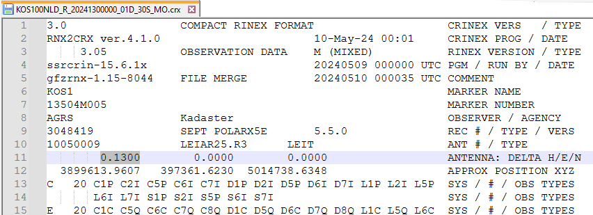
So let's subtract these 13 cm from Altitude already corrected by PCO offsets:
Lat, deg  52.17336096513
Lon, deg  5.8182342110502
Alt, m    104.89927 - 0.13 = 104.76927
Or being converted to XYZ by MEONMAP service:
X, m:  3899613.3919
Y, m:  397362.1691
Z, m:  5014739.0108
That is final PENTAP estimation of KOS1 station geodetical marker PPP position (antenna PCO and antenna height are applied).
|