First table informs about Request ID. Using this ID one may contact KernelSAT team
to check the data and answer questions related to this concrete processing session.
System parameters
| Parameter | Value |
| Request ID | 1829 |
Here we may see detailed information about base and rover files:
General Info | rover.24o | base.24o | | File Size | 16.909 MB (17730668 bytes) | 2.994 MB (3139860 bytes) | | Input decoder | AUTO | AUTO | | Used decoder | RINEX | RINEX | | RINEX version | 3.05
| 3.05
| | Epochs | | Rate | 10.00 Hz | 1.00 Hz | | Total | 4680 | 468 | | Time issues | 0 (0.000% ) | 0 (0.000% ) | | Missed | 0 (0.000% ) | 0 (0.000% ) | | Duration | 0 hours 7 min | 0 hours 7 min | | Time Start | Date: 2024.02.02
Time: 14:03:13.90
DOY: 33
Week: 2299
| Date: 2024.02.02
Time: 14:03:14.00
DOY: 33
Week: 2299
| | Time Stop | Date: 2024.02.02
Time: 14:11:1.80
DOY: 33
Week: 2299
| Date: 2024.02.02
Time: 14:11:1.00
DOY: 33
Week: 2299
| | Receiver Model | -Unknown- | TPS TOPNET | | Receiver FW | -Unknown- | 11.8 Aug 16, 2023 | | Receiver ID | 0 | 0 | | Antenna ID | 000 | 000 | | Antenna Type | -Unknown- | ADVNULLANTENNA |
Post-processing settings as well as statistic of RTK position types are presented further.
Post-Processing Settings | Setting | Value | | Base Coordinates Source | From file | | Used Base Coordinates (ARP) | X: 4359003.8326
Y: 851510.636
Z: 4562632.674
| | Elevation mask, deg | 15.0 |
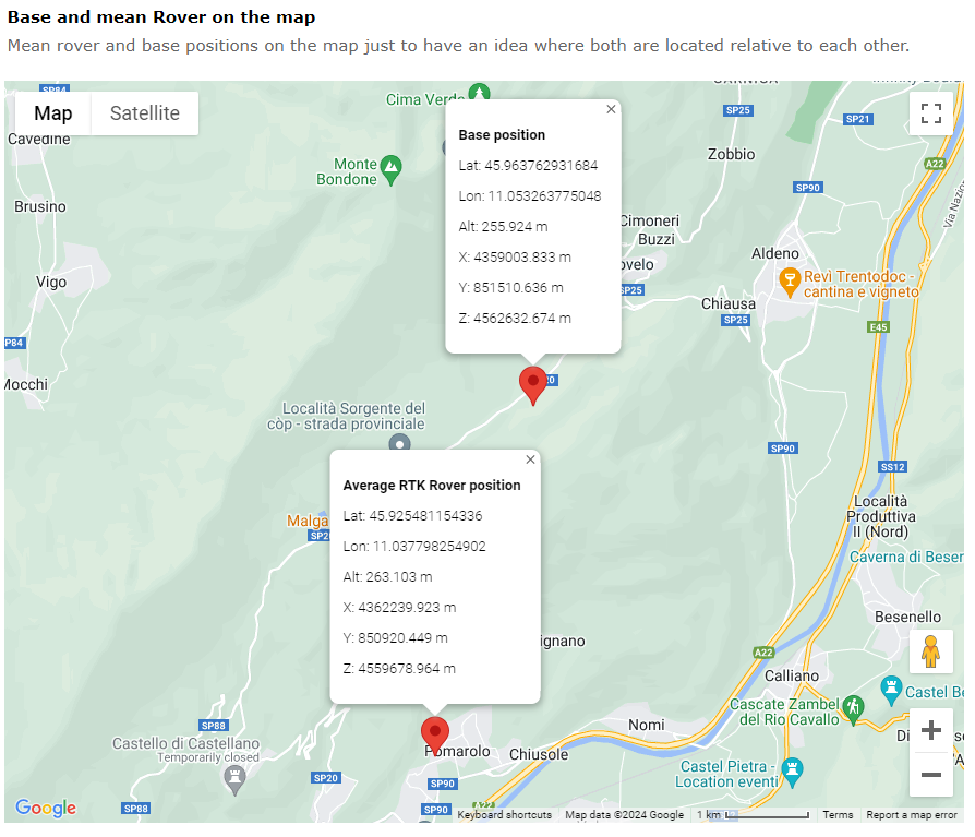
Interactive Map shows base and average rover position.

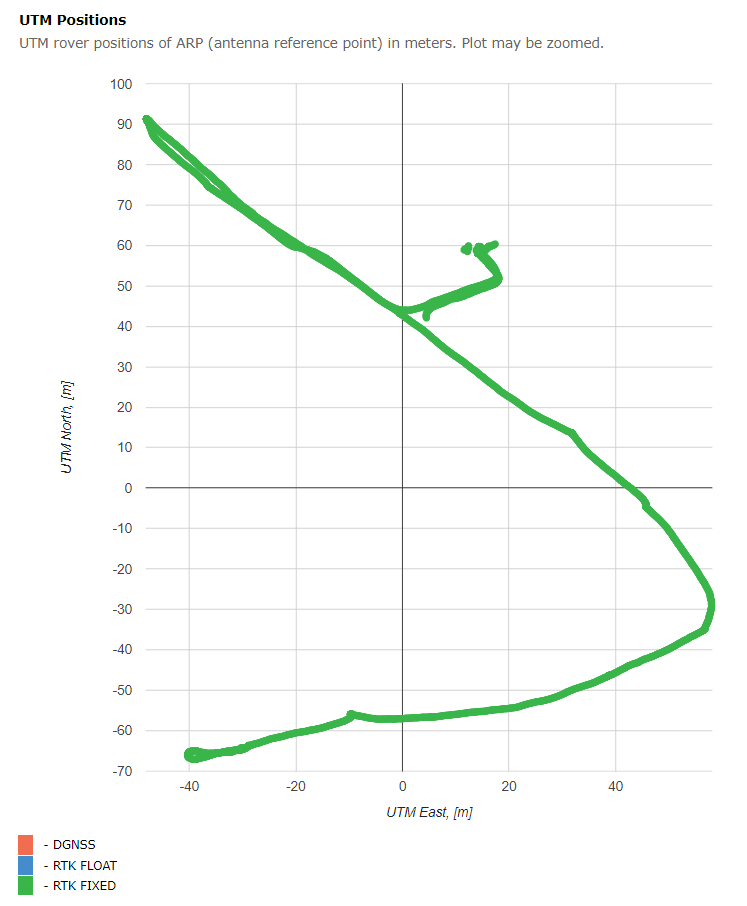
Horizontal positions (UTM) are showed on the next interactive plot. Average is subtracted.
Absolute coordinates as well as baseline components may be found in GGA / CSV files below.

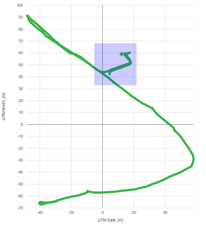
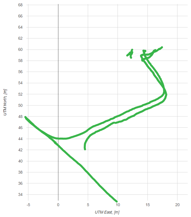
Plot may be zoomed. Select the area of interests by pressed left mouse button. Right mouse button click returns original zoom.


Finally, reckoned positions (epoch-by-epoch) are presented in CSV text form and NMEA GGA message for further analysis and use.
CSV file include TAB separated columns. Columns description is presented below.
# Column Name       Description
#  0      Epoch_ID   Epoch identificator
#  1      Date       GPS Time Date, YMD format
#  2      Time_hms   GPS Time (hms) within day
#  3      Time_ms    GPS Time [ms] within day
#  4      POS_TYPE   Position Type (4 - FIXED, 5 - FLOAT)
#  5      SV_USED    Number of SVs used in RTK solution
#  6      BL_X       X-component of Base-Rover ARP baseline, m
#  7      BL_Y       Y-component
#  8      BL_Z       Z-component
#  9      X          X-coordinate of rover ARP, m
# 10      Y          Y-coordinate
# 11      Z          Z-coordinate
# 12      LAT        Geodetic Latitude of rover ARP, deg
# 13      LON        Longitude, deg
# 14      ALT        Altitude, m
# 15      PDOP       Position DOP
|