|
← Back to Articles
§ 001. GNSS data quick decoding & analysis w/ help of WAY service
|
|
KernelSAT
|
|
2023-Aug-30
|
Table of contents:
|
Sometimes it is needed to get quick statistic overview of GNSS data file before it will be somehow processed. What format / protocol is it? What messages are inside?
How many messages of good CRC? What observations are available - GNSSs, SVs, Signals? What are Max / Mean SNR values?
What is the average position (just to be ensure the file was collected in right place) etc.
So many similar questions may be raised to whom is facing w/ GNSS data analysis and processing.
The article describes how KernelSAT service WAY may help you w/ quick GNSS data pre-analysis.
|
The WAY online utility automatically detects known / supported formats and protocols in uploaded file and gives statistic about detected messages and
compact information about primary data parameters.
As for today (2023-Aug-28), WAY supports the following formats (completely and/or partially):
Please reffer to WAY Home Page for up-to-date status and additional information / details.
|
Example 1. Compact RINEX from BKG
|
|
Let's demonstrate WAY features on concrete examples. For instance, there is some Compact RINEX file we'd like to check and analyze.
Perfect! Let's start. As for file, let's use one concrete from BKG:
https://igs.bkg.bund.de/browseFiles

Where this station is located? How many measurements are inside in fact? Is there QZSS or IRNSS measurements?
All of these questions may be easily answered by WAY.
Once the test file is downloaded from BKG server (and unzipped), let's open
WAY uploading page
First one should select the file to be examined.
WAY supports Compact RINEX format (both version 1 and version 3) thus no need to run RNXCMP utility in advance. Just point to UNBD00CAN_R_20231990000_01D_30S_MO.rnx
file which has just been saved and unzipped.
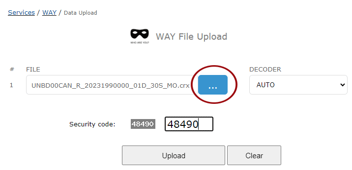
In most of the cases, you may keep DECODER combo-box by default (AUTO). It means that WAY will detect the format on its own.
However, in some specific cases when the file includes data of several GNSS formats - it makes sense to specify concrete one.
For instance, there could be a file w/ NMEA and UBLOX binary (or Septentrio SBF) data logged together.
Final step - verification code is entered and one may press UPLOAD button. The file will be uploaded to the server and started to be processed.
Processing time depends on file size, GNSS data format, epoch rate etc. If file is huge - please wait a little bit, it may take some time.
General statistic section inform us that we have 24h raw data collected on Septentrio POLARX5S receiver w/ FW 5.5.0 onboard.
Data rate is 30 sec. GNSS measurements are presented in RINEX 4 format w/ applied Compact RINEX compression (Hatanaka compressed).
General Info
| Parameter |
Value |
| File name |
UNBD00CAN_R_20231990000_01D_30S_MO.crx |
| File Size |
10.527 MB (11037941 bytes) |
| Input decoder |
AUTO |
| Used decoder |
RINEX |
| RINEX version |
4.0
Hatanaka Compressed (CRX)
|
| Epochs |
| Rate |
30 sec |
| Total |
2880 |
| Time issues |
0 (0.000% ) |
| Missed |
0 (0.000% ) |
| Time start |
2023.07.18 00:00:0.00 |
| Time Stop |
2023.07.18 23:59:30.00 |
| Receiver |
SEPT POLARX5S |
| Receiver FW |
5.5.0 |
| Receiver ID |
3055097 |
Antenna coordinates provided in RINEX header are the following:
Average Coordinates
Average Coordinates over all positions withing the file.
| Average Coordinates |
|
| Lat, deg |
45.950126549681 |
| Lon, deg |
-66.6414659968 |
| Alt, m |
23.115608 |
| X, m |
1761305.900000 |
| Y, m |
-4078238.570000 |
| Z, m |
4561411.350000 |
WAY shows us the position on interactive Google Maps what is quite convinient - we may check
in details the location and its surroundings from point of GNSS obstacles and shadings.
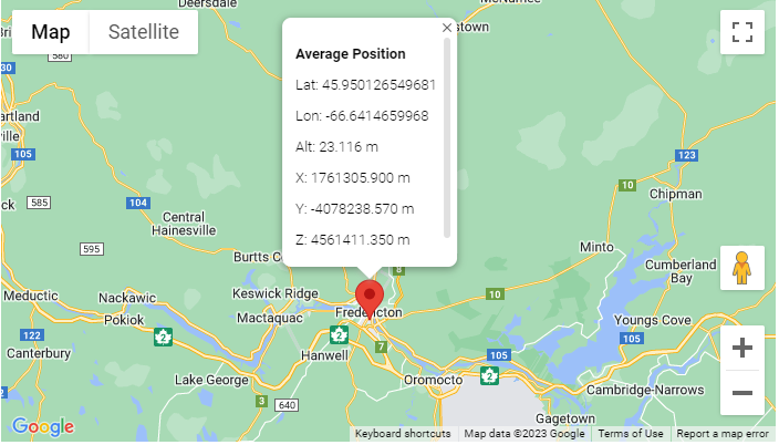
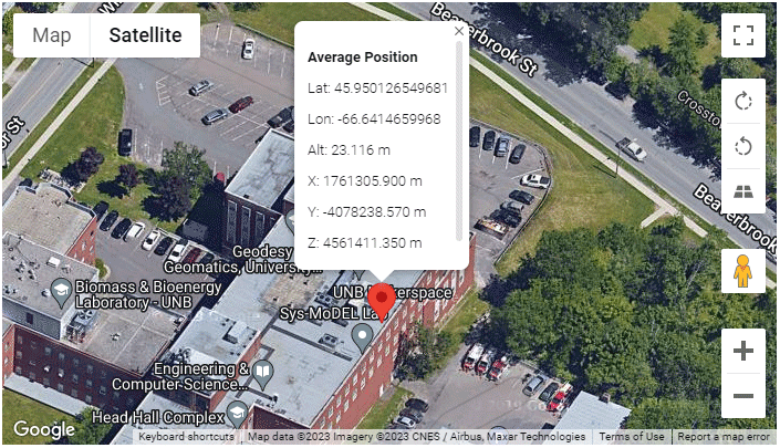
Next, WAY process the whole file, all the epochs, collect measurements of all GNSS, satellites and siganls and forms statistic of number of tracked SVs per each GNSS.
Min / Mean / Max SVs Tracked
Min, mean and max number of tracked SVs per GNSS.
|
SVs Tracked |
| GNSS |
Min |
Mean |
Max |
| GPS |
9 |
10.98 |
14 |
| GLONASS |
7 |
9.09 |
11 |
| SBAS |
5 |
5.88 |
6 |
| GALILEO |
5 |
8.94 |
13 |
| BEIDOU |
6 |
10.78 |
16 |
Here WAY presents details statistic of max & mean SNR per each GNSS and Signal detected over whole file.
It also gives an idea about concrete signals provided in the file.
Max / Mean SNR
Max and mean SNR over all SVs of concrete GNSS and signal.
| GNSS |
Signal |
Max SNR, dbHz |
Mean SNR, dbHz |
| GPS |
L1CA |
52.25 |
44.12 |
| GPS |
L1C(P) |
50.01 |
43.90 |
| GPS |
L1P |
54.12 |
33.34 |
| GPS |
L2C(L) |
51.89 |
41.29 |
| GPS |
L2P |
54.12 |
33.34 |
| GPS |
L5Q |
56.38 |
46.15 |
| GLONASS |
L1CA |
53.23 |
45.38 |
| GLONASS |
L1P |
53.48 |
44.90 |
| GLONASS |
L2CA |
52.29 |
43.37 |
| GLONASS |
L2P |
52.92 |
43.62 |
| SBAS |
L1CA |
43.15 |
38.48 |
| SBAS |
L5I |
37.95 |
35.74 |
| GALILEO |
E1C |
51.90 |
42.51 |
| GALILEO |
E5A(Q) |
53.51 |
43.81 |
| GALILEO |
E6C |
58.14 |
46.36 |
| GALILEO |
E5B(Q) |
54.67 |
44.39 |
| GALILEO |
E5(A+B)(Q) |
56.97 |
47.09 |
| BEIDOU |
B1C(P) |
51.12 |
43.68 |
| BEIDOU |
B1I |
52.02 |
44.46 |
| BEIDOU |
B2a(P) |
53.39 |
44.43 |
| BEIDOU |
B3I |
55.77 |
46.02 |
| BEIDOU |
B2I |
53.59 |
43.42 |
| BEIDOU |
B2b(D) |
52.98 |
44.90 |
In the next table, WAY provides information about SNR (and/or Code) measurements counters. It allows to get idea what concrete satellites were tracked,
what signals were tracked and how many such observables are available per each GNSS, satellite and signal.
Measurements counter (SNR)
Total number of SNR measurements for each GNSS / satellite per Signal.
GPS
Total number of SNR measurements for each satellite per Signal.
| SV |
|
|
|
|
|
|
| G01 |
1056 |
|
1053 |
1047 |
1053 |
1058 |
| G02 |
1107 |
|
1103 |
|
1103 |
|
| G03 |
1123 |
|
1118 |
1109 |
1118 |
1130 |
| G04 |
1112 |
1110 |
1106 |
1105 |
1106 |
1116 |
| G05 |
851 |
|
850 |
846 |
850 |
|
| G06 |
860 |
|
859 |
859 |
859 |
860 |
| G07 |
1102 |
|
1098 |
1061 |
1098 |
|
| G08 |
956 |
|
949 |
933 |
949 |
976 |
| G09 |
1130 |
|
1123 |
1113 |
1123 |
1134 |
| G10 |
1065 |
|
1062 |
1041 |
1062 |
1066 |
| G11 |
864 |
863 |
863 |
864 |
863 |
865 |
| G12 |
1126 |
|
1118 |
1100 |
1118 |
|
| G13 |
1052 |
|
1040 |
|
1040 |
|
| G14 |
999 |
997 |
993 |
992 |
993 |
1008 |
| G15 |
812 |
|
811 |
806 |
811 |
|
| G16 |
827 |
|
819 |
|
819 |
|
| G17 |
876 |
|
875 |
873 |
875 |
|
| G18 |
1093 |
1089 |
1085 |
1092 |
1085 |
1099 |
| G19 |
838 |
|
836 |
|
836 |
|
| G20 |
848 |
|
847 |
|
847 |
|
| G21 |
1115 |
|
1108 |
|
1108 |
|
| G22 |
847 |
|
846 |
|
846 |
|
| G23 |
975 |
972 |
962 |
968 |
962 |
985 |
| G24 |
1055 |
|
1047 |
1043 |
1047 |
1058 |
| G25 |
1104 |
|
1094 |
1086 |
1094 |
1109 |
| G26 |
856 |
|
808 |
805 |
808 |
883 |
| G27 |
1043 |
|
1040 |
1033 |
1040 |
1045 |
| G28 |
866 |
866 |
865 |
865 |
865 |
867 |
| G29 |
1126 |
|
1119 |
1096 |
1119 |
|
| G30 |
1114 |
|
1107 |
1095 |
1107 |
1118 |
| G31 |
858 |
|
857 |
851 |
857 |
|
| G32 |
859 |
|
857 |
857 |
857 |
861 |
GLONASS
Total number of SNR measurements for each satellite per Signal.
| SV |
|
|
|
|
| R01 |
1008 |
1006 |
994 |
985 |
| R02 |
993 |
993 |
975 |
974 |
| R03 |
981 |
976 |
969 |
963 |
| R04 |
1175 |
1180 |
1168 |
1166 |
| R05 |
1221 |
1221 |
1198 |
1189 |
| R06 |
1219 |
1217 |
|
|
| R07 |
1110 |
1107 |
1104 |
1101 |
| R08 |
1016 |
1016 |
1017 |
1013 |
| R09 |
1076 |
1071 |
1068 |
1051 |
| R10 |
982 |
978 |
|
|
| R11 |
974 |
973 |
951 |
948 |
| R12 |
984 |
985 |
977 |
975 |
| R13 |
965 |
959 |
945 |
962 |
| R14 |
1222 |
1218 |
1215 |
1214 |
| R15 |
1248 |
1244 |
1242 |
1239 |
| R16 |
1244 |
1242 |
1221 |
1216 |
| R17 |
1057 |
1055 |
1051 |
1046 |
| R18 |
1081 |
1078 |
1076 |
1075 |
| R19 |
1054 |
1048 |
1061 |
1057 |
| R20 |
1108 |
1098 |
1104 |
1100 |
| R21 |
1187 |
1187 |
1178 |
1177 |
| R22 |
1160 |
1159 |
1142 |
1140 |
| R23 |
1046 |
1045 |
|
|
| R24 |
1012 |
1011 |
990 |
989 |
SBAS
Total number of SNR measurements for each satellite per Signal.
| SV |
|
|
| S131 |
2880 |
2832 |
| S133 |
2880 |
2747 |
| S135 |
2880 |
2752 |
| S136 |
2674 |
416 |
| S148 |
2880 |
|
| S158 |
2736 |
|
GALILEO
Total number of SNR measurements for each satellite per Signal.
| SV |
|
|
|
|
|
| E02 |
1242 |
1241 |
1251 |
1246 |
1243 |
| E03 |
1445 |
1449 |
1446 |
1449 |
1452 |
| E04 |
353 |
357 |
358 |
357 |
357 |
| E05 |
1021 |
1021 |
1022 |
1021 |
1023 |
| E07 |
1513 |
1520 |
1516 |
1516 |
1517 |
| E08 |
1535 |
1534 |
1535 |
1533 |
1533 |
| E09 |
505 |
497 |
502 |
493 |
511 |
| E10 |
916 |
917 |
920 |
917 |
916 |
| E11 |
867 |
863 |
868 |
864 |
861 |
| E12 |
950 |
957 |
959 |
953 |
959 |
| E13 |
1335 |
1331 |
1338 |
1331 |
1332 |
| E14 |
965 |
964 |
965 |
965 |
965 |
| E15 |
1314 |
1312 |
1315 |
1313 |
1315 |
| E18 |
809 |
809 |
810 |
809 |
810 |
| E19 |
780 |
776 |
789 |
781 |
790 |
| E20 |
708 |
|
|
|
|
| E21 |
1016 |
1021 |
1021 |
1018 |
1016 |
| E24 |
857 |
853 |
857 |
855 |
855 |
| E25 |
1017 |
1018 |
1018 |
1018 |
1017 |
| E26 |
1036 |
1038 |
1038 |
1040 |
1039 |
| E27 |
1307 |
1312 |
1315 |
1313 |
1314 |
| E30 |
1437 |
1444 |
1444 |
1445 |
1446 |
| E31 |
782 |
782 |
782 |
782 |
783 |
| E34 |
1074 |
1076 |
1075 |
1075 |
1077 |
| E36 |
854 |
847 |
857 |
855 |
845 |
BEIDOU
Total number of SNR measurements for each satellite per Signal.
| SV |
|
|
|
|
|
|
| C06 |
|
62 |
|
111 |
88 |
|
| C08 |
|
367 |
|
354 |
353 |
|
| C09 |
|
235 |
|
240 |
239 |
|
| C11 |
|
991 |
|
1011 |
1005 |
|
| C12 |
|
984 |
|
987 |
987 |
|
| C13 |
|
400 |
|
384 |
389 |
|
| C14 |
|
1268 |
|
1274 |
1274 |
|
| C16 |
|
171 |
|
123 |
108 |
|
| C19 |
844 |
845 |
850 |
848 |
|
818 |
| C20 |
655 |
658 |
657 |
659 |
|
651 |
| C21 |
1294 |
1303 |
1301 |
1303 |
|
1278 |
| C22 |
1027 |
1026 |
1028 |
1028 |
|
1020 |
| C23 |
1132 |
1137 |
1133 |
1132 |
|
1104 |
| C24 |
1224 |
1224 |
1226 |
1226 |
|
1210 |
| C25 |
1292 |
1296 |
1302 |
1301 |
|
1290 |
| C26 |
1078 |
1092 |
1087 |
1096 |
|
1048 |
| C27 |
1062 |
1068 |
1072 |
1069 |
|
1048 |
| C28 |
896 |
931 |
914 |
922 |
|
887 |
| C29 |
1131 |
1139 |
1137 |
1140 |
|
1114 |
| C30 |
1119 |
1124 |
1120 |
1124 |
|
1092 |
| C32 |
765 |
766 |
766 |
766 |
|
763 |
| C33 |
1240 |
1243 |
1244 |
1247 |
|
1231 |
| C34 |
991 |
1006 |
993 |
1009 |
|
947 |
| C35 |
1038 |
1048 |
1039 |
1049 |
|
1009 |
| C36 |
722 |
722 |
722 |
722 |
|
721 |
| C37 |
943 |
946 |
945 |
952 |
|
931 |
| C38 |
214 |
270 |
190 |
257 |
|
68 |
| C39 |
81 |
150 |
125 |
161 |
|
|
| C40 |
209 |
229 |
175 |
228 |
|
63 |
| C41 |
1157 |
1169 |
1169 |
1169 |
|
1118 |
| C42 |
1278 |
1284 |
1290 |
1290 |
|
1265 |
| C43 |
953 |
958 |
956 |
959 |
|
953 |
| C44 |
899 |
917 |
901 |
905 |
|
891 |
| C45 |
959 |
960 |
960 |
960 |
|
954 |
| C46 |
833 |
837 |
840 |
839 |
|
802 |
| C57 |
|
947 |
|
947 |
|
|
| C58 |
|
20 |
|
20 |
|
|
|
Example 2. RTCM3 Corrections
|
|
This time lets' try to check RTCM3 corrections. For testing purposes, RTCM3 file is logged in advance from GOET00DEU0
mountpoint of euref-ip.net NTRIP Caster.
As usual, just choose the file w/ corrections in WAY interface, keep AUTO decoder mode (or select RTCM3 decoder if
the file may contain mix of different GNSS formats), enter verification code and press UPLOAD button.
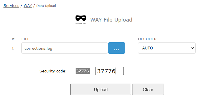
Once uploading and processing are completed, we may see WAY results. As usual, first general information
about file, detected / used protocol and overal statistic about epochs is presented.
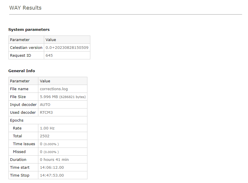
Next, one may find information about detected messages, number of good and bad CRC and messages description.
Messages: RTCM3
| Messsage ID |
Good |
Bad |
Description |
| 1077 |
5005 |
0 |
GPS MSM7 |
| 1087 |
2503 |
0 |
GLONASS MSM7 |
| 1097 |
2503 |
0 |
Galileo MSM7 |
| 1127 |
5006 |
0 |
BeiDou MSM7 |
| 1006 |
83 |
0 |
Stationary RTK Reference Station ARP with Antenna Height |
| 1008 |
83 |
0 |
Antenna Descriptor & Serial Number |
| 1033 |
83 |
0 |
Receiver and Antenna Descriptors |
| 1019 |
7 |
0 |
GPS Ephemerides |
| 1020 |
14 |
0 |
GLONASS Ephemerides |
| 1042 |
10 |
0 |
Beidou Satellite Ephemeris Data |
| 1045 |
29 |
0 |
Galileo F/NAV Satellite Ephemeris Data |
| 1046 |
30 |
0 |
Galileo I/NAV Satellite Ephemeris Data |
Base station coordinates (base position) and base ID is presented in the following table (RTCM3 General Statistic). This information is gathered from [1005] or [1006] RTCM3 messages.
Depending on availability of [1007], [1008], [1033] messages, statistic is also augmented by
information about base receiver model, FW version, serial number (SN) as well as base station antenna and its SN (if available).
RTCM3 General Statistic
Some general statistic and information about RTCM3 stream.
| Parameter |
Value |
|
| Base Station Coordinates [1005] / [1006] |
| Base Station ID |
0 |
| Coordinates, m |
X: 3918911.800
Y: 687523.900
Z: 4968545.600
|
| Antenna Height, m |
0.046 |
| Reference-Station Indicator DF141 |
0
|
0 - Real, Physical Reference Station
|
|
1 - Non-Physical or Computed Reference Station (Network RTK)
|
|
| Receiver Oscillator Indicator DF142 |
1
|
0 - All raw data observations may be measured at different instants
|
|
1 - All raw data observations are measured at the same instant
|
|
| Quarter Cycle Indicator DF364 |
1
|
0 - Correction status unspecified
|
|
1 - PhaseRanges are corrected
|
|
2 - Phase observations are not corrected
|
|
3 – Reserved
|
|
|
| Receiver & Antenna [1007] / [1008] / [1033] |
| Receiver Description |
JAVAD TRE_3 DELTA
|
| Receiver FW |
4.1.06-221128
|
| Receiver SN |
0S67YR9U4JWA90QDSPVJA2QGHS
|
| Antenna Description |
LEIAR25.R4 LEIT
|
| Antenna SN |
10211013
|
Base station position is showed on interactive Google Maps what gives an idea where exactly the base station is located, what is the environment around.
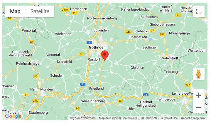
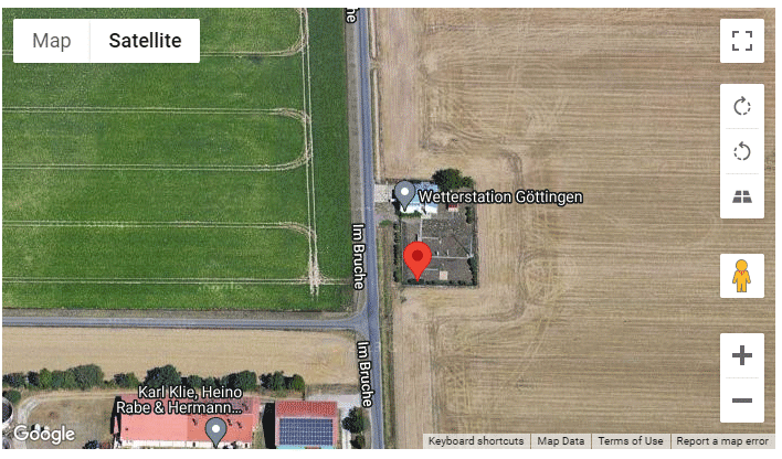
Next, WAY provides analysis of RTCM3 stream and raise warnings in case of obvious issues are
detected (like no base position, base ID change, low number of satellites or bad SNR etc). Please check the article:
§ 002. How WAY service may help in RTCM3 corrections analysis and RTK rover troubleshooting?
It provides many practical examples of affected RTCM3 stream which may prevent RTK rover from being FIXED. WAY may help to identify these problems.
But let's come back to RTCM3 example from Gottingen. Here all is fine, WAY didn't detect any obvious issues in RTCM3 stream. All is GREEN.
WAY RTCM3 Simple analysis
|
+3.0
|
Good! Base coordinates messages [1005] or [1006] are available
RTK base position is VITAL information required for RTK rover operation. W/o it no precise positioning is possible.
|
|
+1.0
|
Good! Antenna Descriptor messages ([1007] or [1008] or [1033]) are available and Antenna type is provided.
RTK rover may have performance issues especially on long base lines if RTK Base antenna type is unknown. Some RTK rovers may even refuse to compose RTK positions at all w/o knowledge of Base Antenna type.
|
|
+1.0
|
Good! Receiver Descriptor messages [1033] is available and Receiver type is provided
RTK rover may have performance issues especially on long base lines if RTK Receiver type is unknown.
Information about Base receiver type may be used by RTK rover for so called inter-receiver GLONASS biases table. These pre-calibrated phase biases being used may speed up GLONASS ambiguity resolution if base and rover are of different manufactures.
Some RTK rovers may even refuse to compose RTK positions at all w/o knowledge of Base Receiver type.
|
|
+3.0
|
Good! Mean number (45.17) of available SVs is OK
Lack of SVs data coming from RTK base directly affects RTK rover performance (TTFF) especially on long base lines or under challenging environment.
|
|
+1.0
|
Good! Max GPS L1CA SNR (51 dbHz) on base is fine.
Low SNR on base may point on issues w/ antenna-feeder tract, wrong system installation, interference etc. All of it may directly affect RTK rover performance resulted in long TTFF, outliers and wrong fixes.
|
|
+1.0
|
Good! Mean GPS L1CA SNR (44.76 dbHz) on base is fine.
Low SNR on base may point on issues w/ antenna-feeder tract, wrong system installation, interference etc. All of it may directly affect RTK rover performance resulted in long TTFF, outliers and wrong fixes.
|
|
+0.5
|
Good! There are no messages w/ bad CRC (0.0000 %). Data link is perfect.
Corrupted messages deprive RTK engine of corrections in time what may degrade RTK rover performance.
|
Next, we may see statistic of number of tracked GNSS detected in observables RTCM3 messages.
Min / Mean / Max SVs Tracked
Min, mean and max number of tracked SVs per GNSS.
|
SVs Tracked |
| GNSS |
Min |
Mean |
Max |
| GPS |
1 |
11.51 |
12 |
| GLONASS |
9 |
9.77 |
10 |
| GALILEO |
7 |
8.57 |
9 |
| BEIDOU |
15 |
15.32 |
17 |
Quite important statistic as well - maximum and average SNR per each detected GNSS and signal. Also gives information about actually available signals types.
Please be aware that these tables may not appear if corrections do not include SNR (for instance RTCM3 messages of MSM3 group).
Max / Mean SNR
Max and mean SNR over all SVs of concrete GNSS and signal.
| GNSS |
Signal |
Max SNR, dbHz |
Mean SNR, dbHz |
| GPS |
L1CA |
51.00 |
44.76 |
| GPS |
L1C(D+P) |
51.00 |
49.40 |
| GPS |
L1P |
53.00 |
39.32 |
| GPS |
L2P |
53.00 |
39.32 |
| GPS |
L2C(L+M) |
53.00 |
44.68 |
| GPS |
L5(I+Q) |
58.00 |
51.93 |
| GLONASS |
L1CA |
56.00 |
47.83 |
| GLONASS |
L1P |
56.00 |
47.61 |
| GLONASS |
L2CA |
51.00 |
44.17 |
| GLONASS |
L2P |
50.00 |
43.50 |
| GALILEO |
E1(B+C) |
52.00 |
46.70 |
| GALILEO |
E5A(I+Q) |
56.00 |
47.97 |
| GALILEO |
E6(B+C) |
53.00 |
45.70 |
| GALILEO |
E5B(I+Q) |
57.00 |
48.40 |
| GALILEO |
E5(A+B)(I+Q) |
59.00 |
51.05 |
| BEIDOU |
B1C(D+P) |
51.00 |
45.34 |
| BEIDOU |
B1I |
52.00 |
44.37 |
| BEIDOU |
B2a(D+P) |
57.00 |
48.59 |
| BEIDOU |
B3I |
53.00 |
44.68 |
| BEIDOU |
B2I |
53.00 |
42.30 |
SNR (or Code) measurements counters - allow to get idea what concrete satellites are provided by RTK Base, what signals and how many such observables.
May be RTK rover can't get FIX because RTK Base doesn't track L2 frequency? The table perfectly shed light on such hypothesis. This time all is fine.
GPS
Total number of SNR measurements for each satellite per Signal.
| SV |
|
|
|
|
|
|
| G03 |
1356 |
|
1374 |
1374 |
1395 |
1399 |
| G04 |
2501 |
2501 |
2501 |
2501 |
2501 |
2501 |
| G05 |
2386 |
|
2382 |
2382 |
2386 |
|
| G06 |
2501 |
|
2501 |
2501 |
2501 |
2501 |
| G07 |
2501 |
|
2501 |
2501 |
2501 |
|
| G09 |
2501 |
|
2501 |
2501 |
2501 |
2501 |
| G11 |
2501 |
2501 |
2501 |
2501 |
2501 |
2501 |
| G16 |
2501 |
|
2501 |
2501 |
|
|
| G20 |
2501 |
|
2501 |
2501 |
|
|
| G26 |
2501 |
|
2436 |
2436 |
2501 |
2501 |
| G29 |
2502 |
|
2502 |
2502 |
2502 |
|
| G30 |
2501 |
|
2501 |
2501 |
2501 |
2501 |
GLONASS
Total number of SNR measurements for each satellite per Signal.
| SV |
|
|
|
|
| R01 |
2502 |
2502 |
2502 |
2495 |
| R02 |
2502 |
2502 |
2502 |
2502 |
| R03 |
2502 |
2502 |
2502 |
2502 |
| R04 |
1981 |
1979 |
1974 |
1915 |
| R11 |
2502 |
2502 |
2502 |
2502 |
| R12 |
2502 |
2502 |
2502 |
2502 |
| R13 |
2502 |
2502 |
2502 |
2502 |
| R17 |
2453 |
2453 |
2453 |
2394 |
| R18 |
2502 |
2502 |
2502 |
2502 |
| R19 |
2502 |
2502 |
2502 |
2502 |
GALILEO
Total number of SNR measurements for each satellite per Signal.
| SV |
|
|
|
|
|
| E03 |
784 |
782 |
782 |
782 |
776 |
| E04 |
2502 |
2502 |
2501 |
2502 |
2502 |
| E05 |
2502 |
2502 |
2502 |
2502 |
2502 |
| E09 |
2502 |
2502 |
2502 |
2502 |
2502 |
| E11 |
860 |
860 |
848 |
843 |
851 |
| E15 |
2502 |
2502 |
2501 |
2502 |
2502 |
| E21 |
1538 |
1538 |
1538 |
1538 |
1538 |
| E24 |
757 |
752 |
753 |
753 |
740 |
| E31 |
2502 |
2502 |
2502 |
2502 |
2502 |
| E34 |
2502 |
2502 |
2502 |
2502 |
2502 |
| E36 |
2502 |
2502 |
2502 |
2502 |
2502 |
BEIDOU
Total number of SNR measurements for each satellite per Signal.
| SV |
|
|
|
|
|
| C05 |
|
2502 |
|
2502 |
2502 |
| C06 |
|
2502 |
|
2502 |
2502 |
| C07 |
|
45 |
|
45 |
81 |
| C09 |
|
2502 |
|
2502 |
2502 |
| C14 |
|
2502 |
|
2502 |
2502 |
| C16 |
|
1802 |
|
1829 |
1893 |
| C24 |
2502 |
2502 |
2502 |
2502 |
|
| C25 |
2502 |
2502 |
2502 |
2502 |
|
| C26 |
2502 |
2502 |
2502 |
2502 |
|
| C27 |
2502 |
2502 |
2502 |
2502 |
|
| C28 |
2502 |
2502 |
2502 |
2502 |
|
| C30 |
2502 |
2502 |
2502 |
2502 |
|
| C32 |
1304 |
1317 |
1326 |
1317 |
|
| C33 |
2502 |
2502 |
2502 |
2502 |
|
| C41 |
2502 |
2502 |
2502 |
2502 |
|
| C42 |
2502 |
2502 |
2502 |
2502 |
|
| C60 |
|
2502 |
|
1482 |
|
|
Example 3. Septentrio SBF
|
|
WAY service is also capable of reading and decoding binary Septentrio SBF format. Let's demonstrate it on some concrete example.
SBF files may be taken from GAGE UNAVCO server.
For instance, it could be the file neah0010.23_a.sbf (see illustration below).
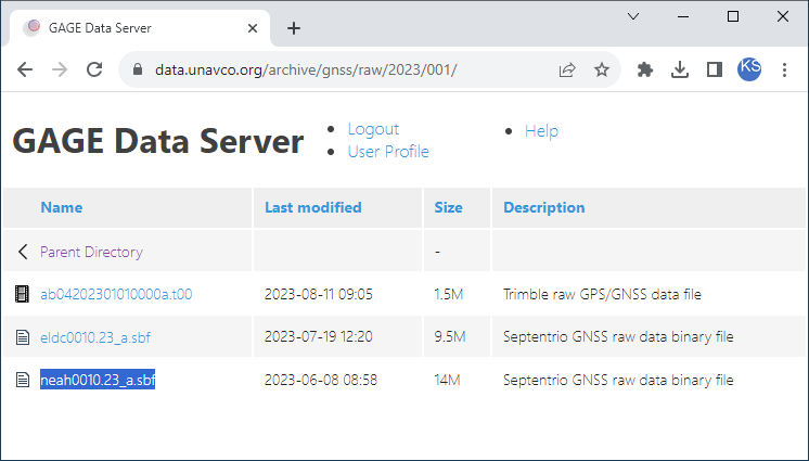
Please, download the file from UNAVCO server and than, as usual, upload the file into WAY. Wait till processing is completed.
General info section gives us an idea that: it is indeed binary SBF file w/ data update rate of 15 sec.
In total, we have about 10.5 h of data for analysis.
General Info
| Parameter |
Value |
| File name |
neah0010.23_a.sbf |
| File Size |
13.723 MB (14390032 bytes) |
| Input decoder |
AUTO |
| Used decoder |
SBF |
| Epochs |
| Rate |
15 sec |
| Total |
2526 |
| Time issues |
0 (0.000% ) |
| Missed |
0 (0.000% ) |
| Time start |
2023.01.01 00:00:0.00 |
| Time Stop |
2023.01.01 10:31:15.00 |
List of detected SBF blocks (messages) is presented below. All messages are good, no bad CRC detected.
Messages: Septentrio SBF
| Block ID |
Block Name |
Good |
Bad |
Description |
| 4027 |
MeasEpoch |
2528 |
0 |
Measurement set of one epoch |
| 4007 |
PVTGeodetic |
2527 |
0 |
GNSS position, velocity, and time in geodetic coordinates |
| 4015 |
Commands |
1 |
0 |
Commands entered by the user |
| 5902 |
ReceiverSetup |
1 |
0 |
General information about the receiver installation |
| 5891 |
GPSNav |
93 |
0 |
GPS ephemeris and clock |
| 5893 |
GPSIon |
831 |
0 |
Ionosphere data from the GPS subframe |
| 4002 |
GALNav |
770 |
0 |
Galileo ephemeris, clock, healthand BGD |
| 4030 |
GALIon |
1 |
0 |
NeQuick Ionosphere model parameters |
| 4004 |
GLONav |
186 |
0 |
GLONASS ephemeris and clock |
| 4081 |
BDSNav |
120 |
0 |
BeiDou ephemeris and clock |
| 4120 |
BDSIon |
1 |
0 |
BeiDou Ionospheric delay model parameters |
| 5896 |
GEONav |
1335 |
0 |
MT09 : SBAS navigation message |
| 4031 |
GALUtc |
3262 |
0 |
GST - UTC data |
| 4032 |
GALGstGps |
2008 |
0 |
GST - GPS data |
| 5894 |
GPSUtc |
50 |
0 |
GPS - UTC data from GPS subframe |
| 4095 |
QZSNav |
6 |
0 |
QZSS ephemeris and clock |
Interesting, looks like the receiver is running in PPP (Precise Point Positioning) mode.
Position Types
| Position type |
|
| PPP_FLOAT |
2526 (100.000%) |
Horizontal and vertical precision definitely confirms it. Percentile 99.9% is less than 7 cm in
horizontal (means that 99.9% yields within the file have horizontal positioning precision error no more than 6.78 cm).
Horizontal Precision
Horizontal positions precision against average coordinates. Has sense only for static receiver.
| Metric |
Precision, m |
| Sample size |
2526 |
| RMS |
0.038029 |
| 50 % |
0.035710 |
| 68 % |
0.042167 |
| 90 % |
0.053900 |
| 95 % |
0.057480 |
| 99 % |
0.061923 |
| 99.9 % |
0.067844 |
Vertical Precision
Vertical positions precision against average coordinates. Has sense only for static receiver.
| Metric |
Precision, m |
| Sample size |
2526 |
| RMS |
0.068437 |
| 50 % |
0.053406 |
| 68 % |
0.075836 |
| 90 % |
0.114380 |
| 95 % |
0.126434 |
| 99 % |
0.135925 |
| 99.9 % |
0.144714 |
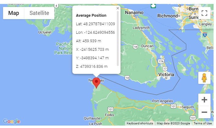
Average coordinates (over all positions within the file) are the following:
Average Coordinates
Average Coordinates over all positions withing the file.
| Average Coordinates |
|
| Lat, deg |
48.297878411009 |
| Lon, deg |
-124.6249094556 |
| Alt, m |
459.939393 |
| X, m |
-2415625.703464 |
| Y, m |
-3498394.146689 |
| Z, m |
4739316.836467 |
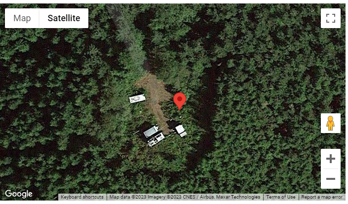
Thanks to position on GMap, we may see in details where the receiver is located. The receiver is installed in quite forestry place.
Would be interesting to check Multipath environment (MP1 / MP2 combination) as well as satellite visibility as function of elevation.
KernelSAT is planning to add in coming future TEQCMate online
service specifically aimed to perform base station measurements quality assesment (similar to what UNAVCO teqc utility does).
Next, we may observe standard measurements statistic, as number of tracked satellites per each GNSS:
Min / Mean / Max SVs Tracked
Min, mean and max number of tracked SVs per GNSS.
|
SVs Tracked |
| GNSS |
Min |
Mean |
Max |
| GPS |
6 |
9.56 |
12 |
| GLONASS |
6 |
7.59 |
10 |
| SBAS |
3 |
3.00 |
3 |
| QZSS |
0 |
0.52 |
1 |
| GALILEO |
6 |
7.88 |
10 |
| BEIDOU |
6 |
8.51 |
11 |
As well as detailed statistic per each GNSS, satellite and signal. For instance, one may see that QZSS L6 signal is tracked (MADOCA or CLAS PPP)?
Max / Mean SNR
Max and mean SNR over all SVs of concrete GNSS and signal.
| GNSS |
Signal |
Max SNR, dbHz |
Mean SNR, dbHz |
| GPS |
L1CA |
52.00 |
39.33 |
| GPS |
L1C(P) |
40.50 |
35.18 |
| GPS |
L1P |
48.50 |
32.39 |
| GPS |
L2C(L) |
42.00 |
31.22 |
| GPS |
L2P |
48.50 |
32.39 |
| GPS |
L5Q |
56.00 |
43.18 |
| GLONASS |
L1CA |
52.50 |
36.38 |
| GLONASS |
L1P |
53.25 |
35.33 |
| GLONASS |
L2CA |
51.00 |
37.44 |
| GLONASS |
L2P |
46.00 |
34.26 |
| SBAS |
L1CA |
45.50 |
43.71 |
| SBAS |
L5I |
30.25 |
28.89 |
| QZSS |
L1CA |
32.25 |
25.63 |
| QZSS |
L1C(P) |
30.00 |
26.48 |
| QZSS |
L2C(L) |
30.00 |
25.49 |
| QZSS |
L5Q |
42.00 |
38.42 |
| QZSS |
L6P |
30.50 |
25.79 |
| GALILEO |
E1C |
50.00 |
32.63 |
| GALILEO |
E5A(Q) |
52.00 |
38.47 |
| GALILEO |
E6C |
48.75 |
34.33 |
| GALILEO |
E5B(Q) |
52.75 |
35.90 |
| GALILEO |
E5(A+B)(Q) |
48.75 |
37.39 |
| BEIDOU |
B1C(P) |
41.00 |
31.92 |
| BEIDOU |
B1I |
52.75 |
35.74 |
| BEIDOU |
B2a(P) |
51.25 |
35.93 |
| BEIDOU |
B3I |
54.25 |
37.93 |
| BEIDOU |
B2I |
52.50 |
37.29 |
The article presented several examples of how to quikly check GNSS data and do minimal assesment and analysis using KernelSAT WAY online service.
WAY supports many different GNSS formats and protocols - not all of them were presented in this article.
Please reffer to WAY Home Page for up-to-date
status of supported formats, protocols and messages.
|